Old and inaccurate scans
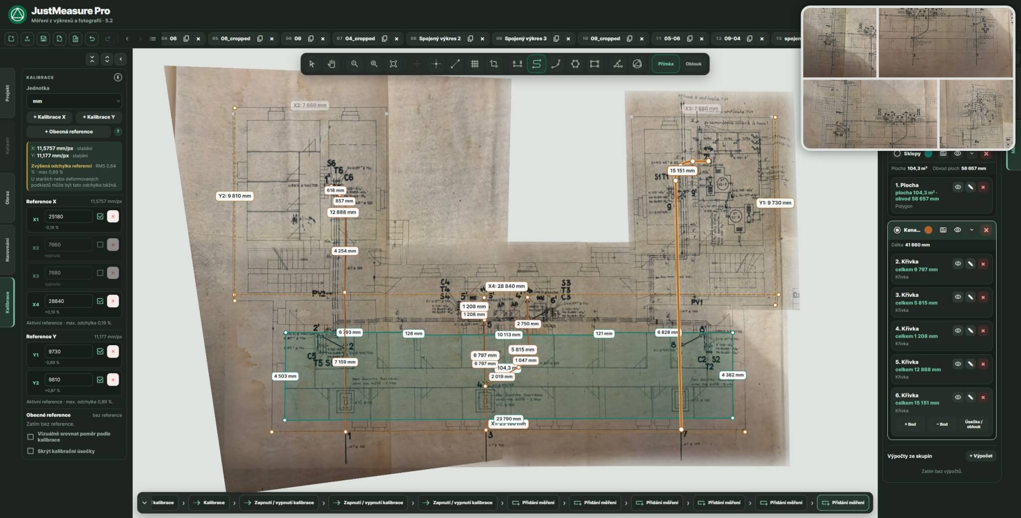
A drawing does not have to be perfectly straight or use exactly the same scale in both axes.
JustMeasure helps straighten, calibrate and measure scans, PDFs and photographs — and work directly with a georeferenced ČÚZK cadastral map and orthophoto. Everything runs in your browser, without an unnecessarily complex CAD workflow.
A drawing does not have to be perfectly straight or use exactly the same scale in both axes.
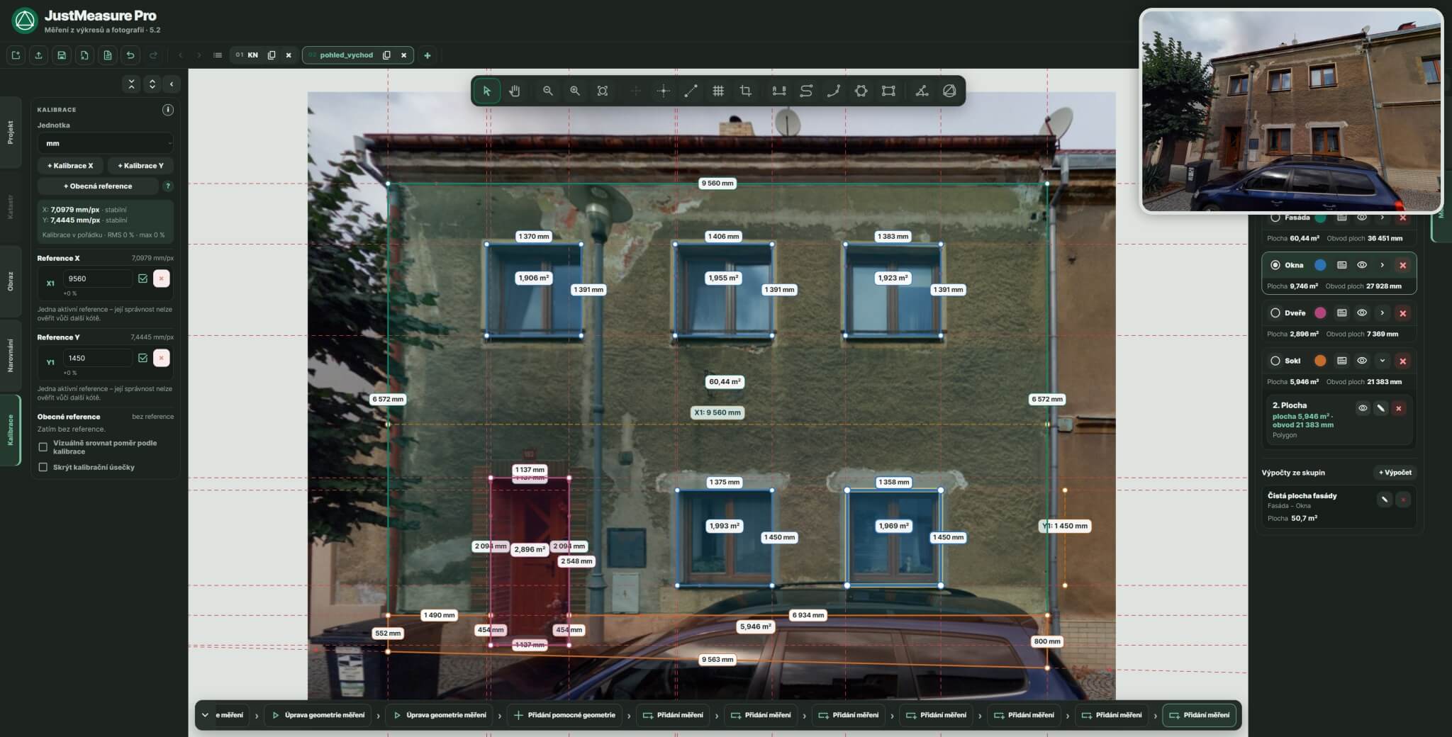
You can also work with photographs of documents, buildings or other source materials that need to be calibrated and measured.
JustMeasure handles perspective distortion as well as more complex local deformation of the source material.
JustMeasure works with both image-based source materials and a georeferenced cadastral map. Each type follows its own natural workflow.
PDF, JPG or PNG. One source or multiple drawings in tabs.
Perspective, rotation, crop and, when needed, advanced deformation corrections.
Use known dimensions as references and build a calibration that matches the source.
Lengths, areas, angles, arcs, circles and other geometric values you need.
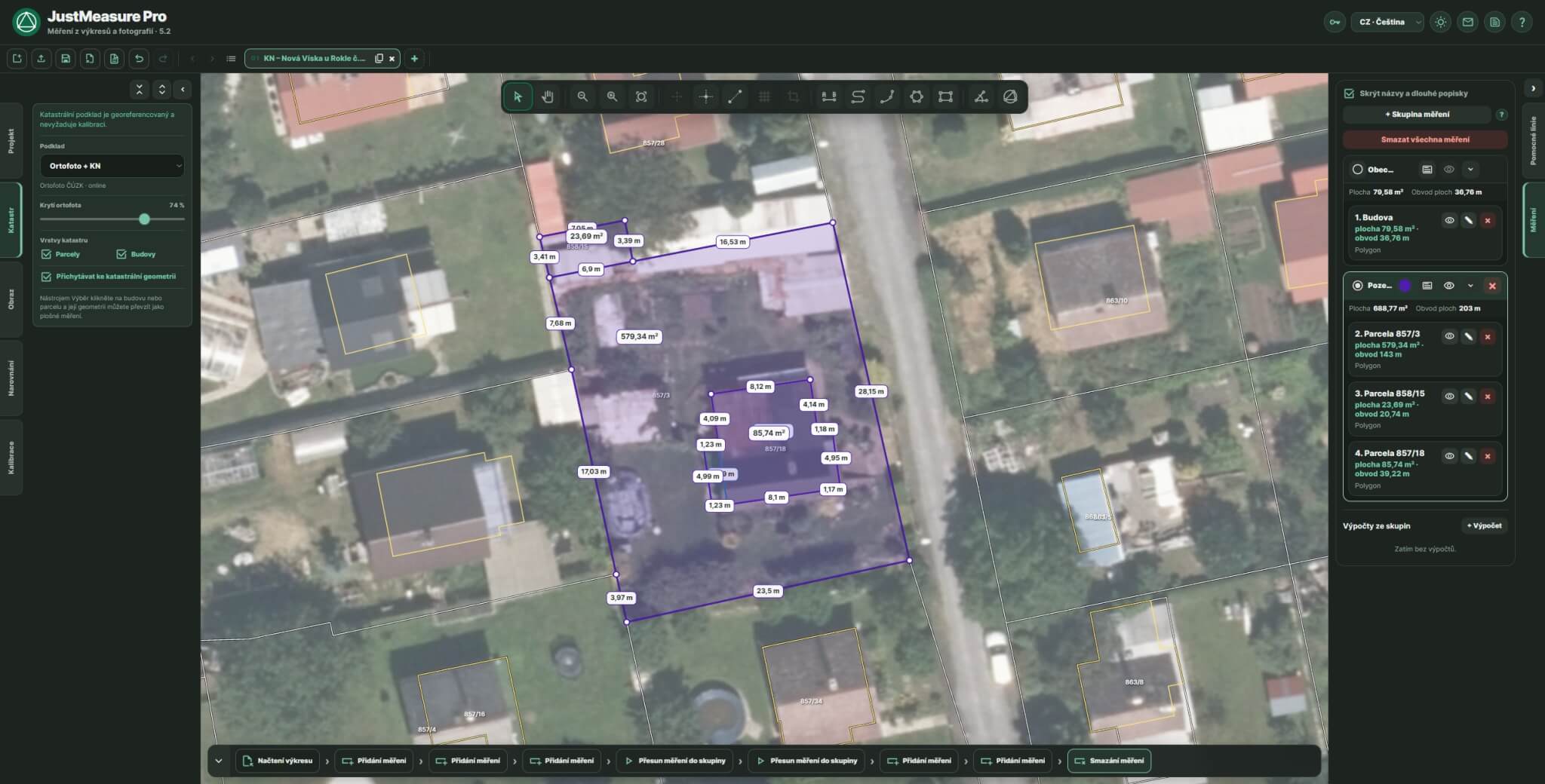
Search an address or area in RÚIAN, or select a property directly from the map.
A georeferenced tab is created with parcels, buildings and optional ČÚZK orthophoto.
Use Select to choose a parcel or building directly in the map.
Turn the geometry into a normal editable area measurement. No calibration is required.
Identify the property, load a georeferenced cadastral map and work directly with parcels and buildings. The cadastral layer can be combined with ČÚZK orthophoto and used as another technical source in the project.
Property and Cadastre features are included in both Basic and PRO.
JustMeasure combines everyday measuring with tools for situations where the source is imperfect — or is not an image-based drawing at all.
RÚIAN, KN data, a georeferenced cadastral map, orthophoto and conversion of parcels or buildings into area measurements.
Straighten photographed or distorted sources using reference lines and corners.
Multiple references, independent X/Y calibration and, in PRO, general references in any direction with deviation diagnostics.
Correct local deformation in warped, folded or obliquely photographed source materials.
Combine multiple photographs or drawing fragments into one source directly in the main workspace.
Organize measurements into coloured groups and create named sums and differences of areas, perimeters or lengths.
JustMeasure works with real technical source materials — cadastral geometry, scans and photographs. Current 5.2 interface screenshots are being prepared for v19.
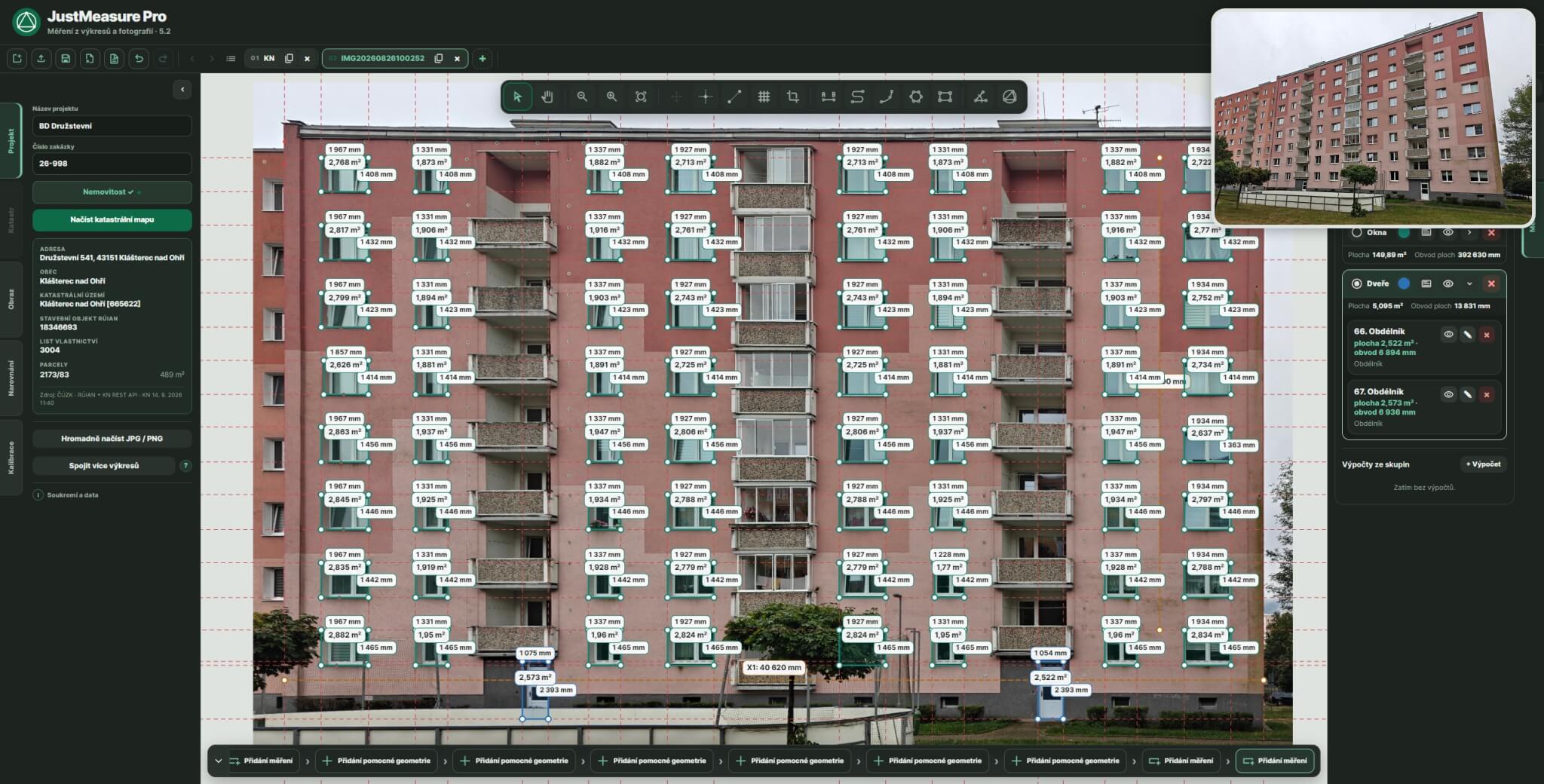
JustMeasure is for people who need to obtain usable dimensions from available source materials without a lengthy workaround.
JustMeasure is developed by Jan Richter, an energy specialist with more than 10 years of professional experience.
The application grew out of a practical need to work with old drawings, inaccurate scans and photographs from which usable dimensions had to be obtained for further professional work.
That is why JustMeasure is not a general graphics editor or a CAD replacement. It focuses on a specific technical problem: preparing and measuring real-world source material — from an old scan or photograph to cadastral geometry.
Image source materials and .justm projects are processed locally in your browser and are not uploaded to the JustMeasure server. Property and Cadastre features use public ČÚZK services; when KN data is retrieved, the selected identifier passes through the JustMeasure licensing backend to the ČÚZK KN REST API.
The Trial unlocks every feature of the current PRO edition for 30 days, so you can test JustMeasure on real work.
Try the complete JustMeasure experience including cadastre, Mesh Warp, MultiStitch and every PRO feature.
Full-featured work with common drawings and photographs plus a georeferenced ČÚZK cadastral map.
PRO extends Basic with tools for complex deformation, source stitching, general calibration, measurement organization and reports.
The Trial includes all features of the PRO edition for 30 days.
| Feature | Basic | PRO |
|---|---|---|
JPG, PNG, PDF, tabs and .justm projects | ✓ | ✓ |
| Property identification, RÚIAN, KN data and ČÚZK cadastral map | ✓ | ✓ |
| ČÚZK orthophoto and snapping to cadastral geometry | ✓ | ✓ |
| Conversion of parcels and buildings to area measurements | ✓ | ✓ |
| Crop, rotation and perspective correction | ✓ | ✓ |
| Calibration along the X and Y axes | ✓ | ✓ |
| General calibration in any direction | — | ✓ |
| Measurement of lengths, areas, angles, arcs and circles | ✓ | ✓ |
| Comparison grid – straightening deformed source materials | — | ✓ |
| MultiStitch – combining a source from multiple parts | — | ✓ |
| Measurement groups + totals and calculations | — | ✓ |
| PDF measurement report | — | ✓ |
| Image modes – black and white, high contrast | — | ✓ |
| Pixel grid | — | ✓ |
| Lens distortion correction | ✓ | ✓ |
| Calibration diagnostics and deviation checks | — | ✓ |
| Helper geometry | ✓ | ✓ |
| Ortho mode | ✓ | ✓ |
| Local file processing without uploading to a server | ✓ | ✓ |
Have an active Trial and are not sure about the right workflow? Leave your phone number and email. I will get back to you and arrange a short video call where we can work through your drawing or photograph directly in JustMeasure.
Essential answers before you start. Detailed guides and a more complete Q&A will be available in JustMeasure Help.
Go to Help →JustMeasure is a tool for working with drawings, photographs and cadastral source materials from which you need dimensions and areas. Image sources can be straightened and calibrated; georeferenced cadastral data can be used directly with parcels and buildings.
Yes. Property and Cadastre features are included in both Basic and PRO. JustMeasure can search through RÚIAN, retrieve KN data, load a georeferenced ČÚZK cadastral map and orthophoto, snap to cadastral geometry and convert a parcel or building into an area measurement.
Yes. The source can be rotated, corrected for perspective and calibrated using known dimensions. The PRO edition also includes Mesh Warp and other tools for more complex source deformations.
Accuracy depends primarily on the quality of the source material, correct straightening and the quality of calibration. That is why we do not claim a universal percentage accuracy that would not be realistic for every source.
No. JustMeasure runs directly in a web browser at app.justmeasure.cz.
Basic includes the complete core toolset for source preparation, cadastral data, calibration and measurement. PRO adds Mesh Warp, MultiStitch, general calibration, diagnostics, Measurement Groups and Group Calculations, PDF reports and other advanced features.
Yes. The Trial unlocks all features of the current PRO version for 30 days.
One licence can be used on up to three devices, for example a work computer, a laptop and a home computer.


